By: Sgt Mike Ward
This past August 2014, the Joint Task Force Pacific Geomatics section (JTFP Geo) was tasked to provide geospatial engineering support (mapping) to Ex KOOTENAY COUGAR 2014. Deploying as a Geospatial Engineering Support team (GST) with a Deployable Geospatial Support System (DGSS), Sgt Mike Ward and MCpl Kevin Sutherland provided various geospatial products and services over the course of the exercise which took place in Trail, British Columbia from 17-28 Aug 2014.
Ex KOOTENAY COUGAR 2014 was 39 Canadian Brigade Group’s (39 CBG) major training event of the year. The exercise was organized as a military skills competition to challenge Army Reserve soldiers in the principles of “shoot, move, and communicate”. The exercise also confirmed the readiness and capability of 39 CBG to respond as part of Canadian Armed Forces (CAF) assistance during domestic emergencies or expeditionary operations.
From JTFP Geo’s perspective the primary goal of this tasking was to test and trial the ability of the GST to provide deployed geospatial engineering support utilizing its newly acquired DGSS within a headquarters element. As the Army Reserves do not currently possess an organic geospatial engineering support capability, this tasking also provided a unique opportunity for Regular Force members to work side by side with their Reserve colleagues, and provide a capability and level of support that would not normally be available.
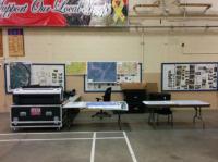
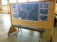
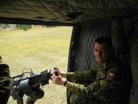
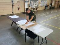
As far as exercises go, Ex KOOTENAY COUGAR was a great experience for the GST. For the duration of the exercise the GST was billeted in modular tents behind the Trail Armoury and operated from within the armoury building itself. A typical working day ran from 0800 hrs to 2100 hrs with a couple of late evenings thrown in for good measure to address various last minute requests. The geospatial engineering support provided comprised of terrain analysis, terrain visualization, custom mapping, data collection, data conversion/conditioning and employing a print-on-demand capability. This support was primarily leveraged by exercise control (EXCON) but also by the individual units of the primary and secondary training audience. While on exercise the GST had the opportunity to participate in jungle lanes, fly in a CH-146 Griffon helicopter and explore, survey and map routes through the mountainous terrain surrounding the Trail area.
Overall Ex KOOTENAY COUGAR 2014 was a success for the GST and the geospatial engineering support provided both before and during the exercise was extremely well received by 39 CBG. The exercise accomplished a number of things. It afforded an excellent opportunity for the GST to trial its new deployable systems; established a baseline for developing SOPs that will enhance future deployments; and continue to cement a good working relationship between JTFP and 39 CBG in prep for future contingency ops within BC.


